Monongahela National Forest
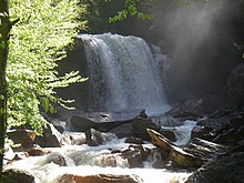
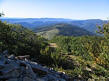
National forest in West Virginia, United StatesThe Monongahela National Forest is a national forest located in the Allegheny Mountains of eastern West Virginia, US. It protects over 921,000 acres of federally managed land within a 1,700,000 acres proclamation boundary that includes much of the Potomac Highlands Region and portions of 10 counties.
Read article
Top Questions
AI generatedMore questions
Nearby Places
Davis & Elkins College
Private college in Elkins, West Virginia, US
Augusta Heritage Festival
Harshith Goud

Graceland (Elkins, West Virginia)
Historic house in West Virginia, United States

Senator Stephen Benton Elkins House
Historic house in West Virginia, United States

Davis and Elkins Historic District
Historic district in West Virginia, United States

Davis Memorial Presbyterian Church
Church in Elkins, West Virginia

Warfield-Dye Residence
Historic house in West Virginia, United States

Albert and Liberal Arts Halls
United States historic place


